
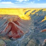
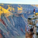
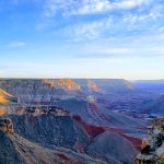
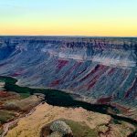
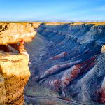
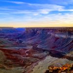
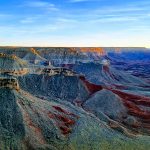
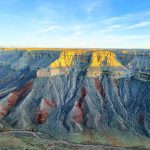
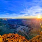
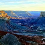
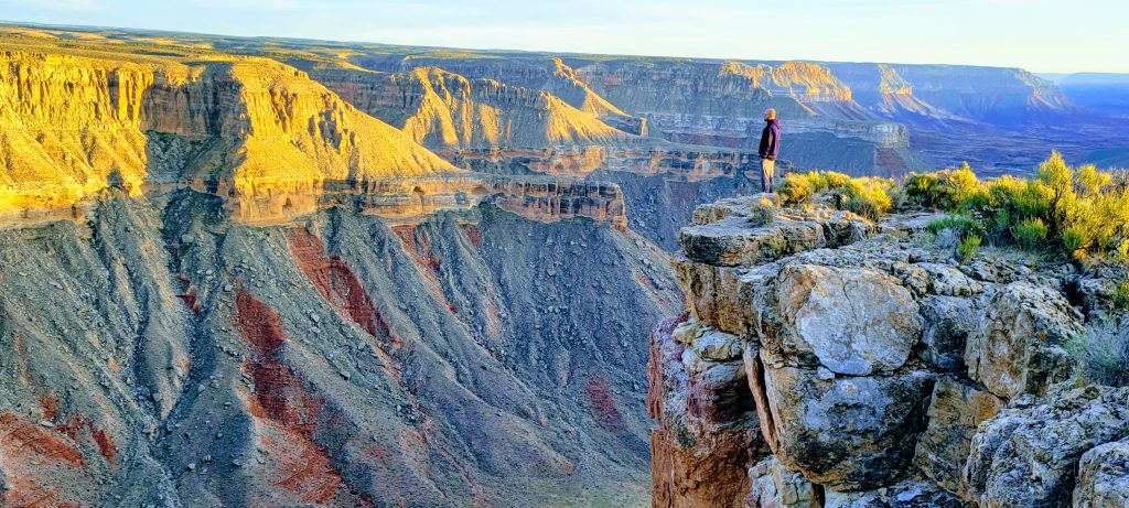
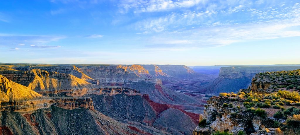
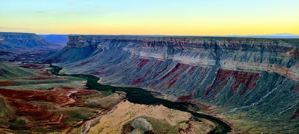
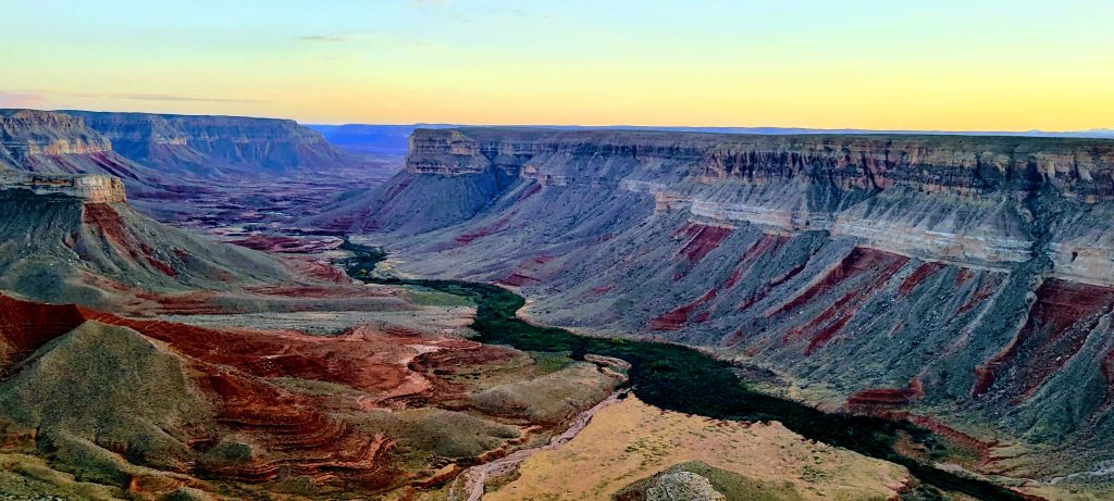
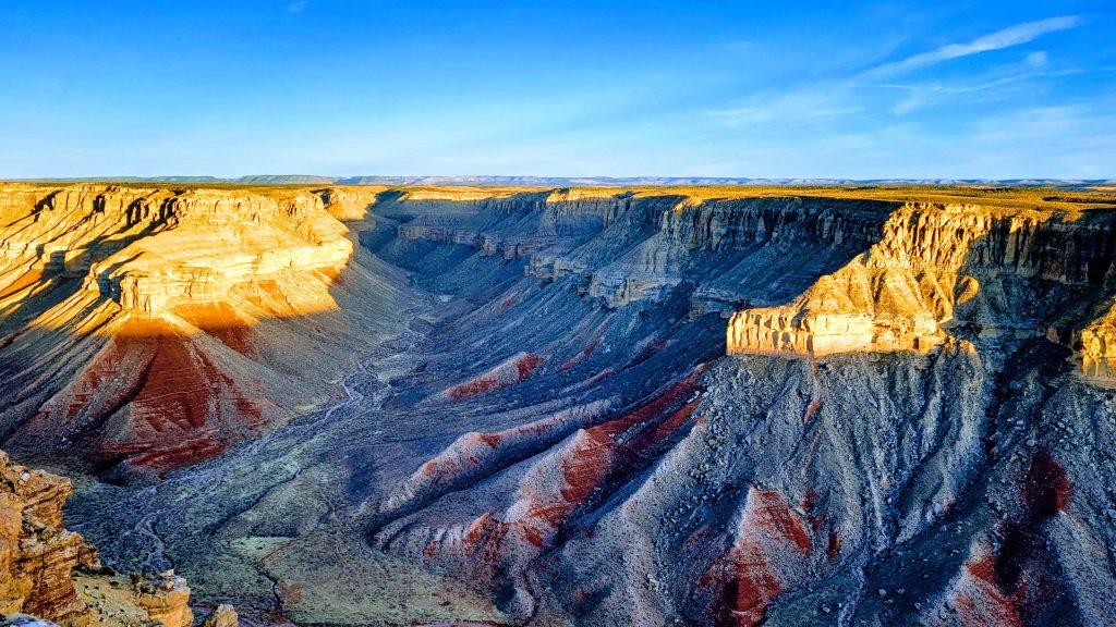
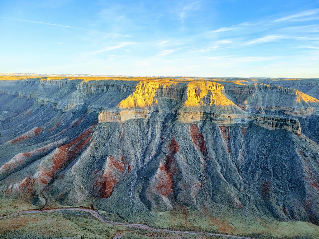
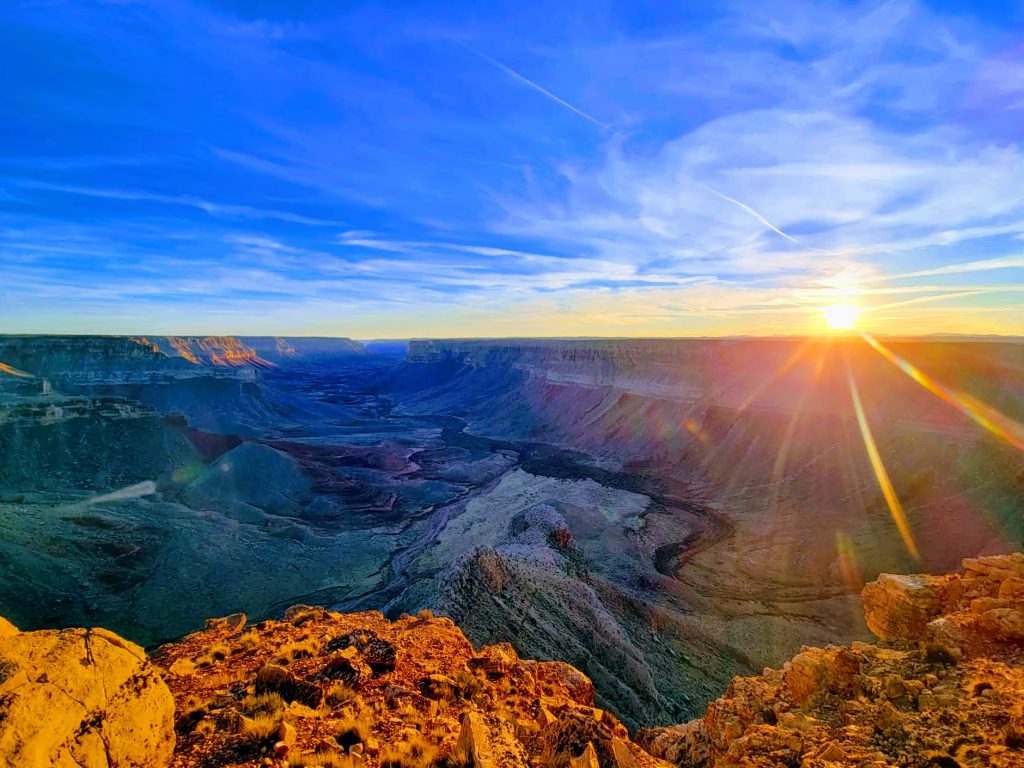
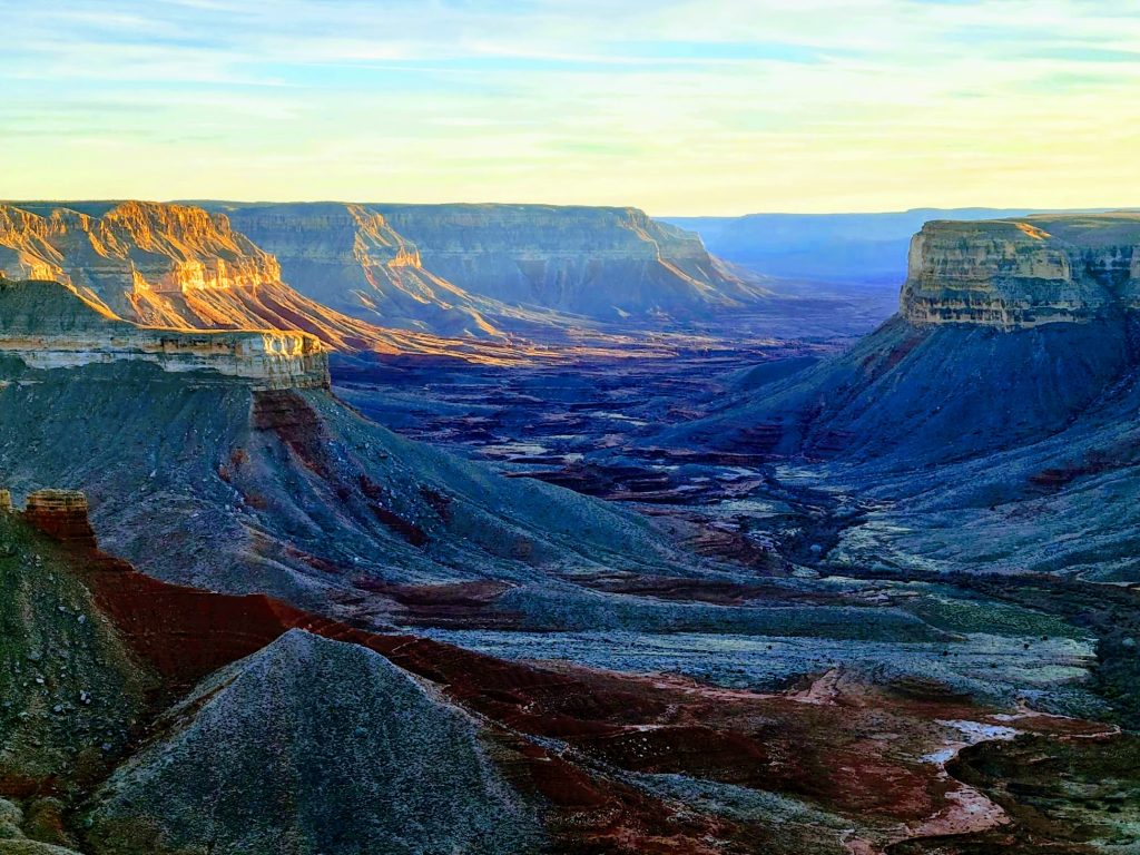
Turning your attention Southward from Kanab and the Zion NP area in search of adventure, there’s one natural wonder of the world that will surely catch the eye and ignite the imagination. The Grand Canyon is one of the great natural wonders of the world, and Gunsight Point offers a secluded, intimate and breathtaking experience with two of the major drainages off the North rim.
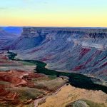
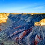
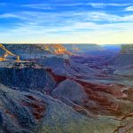
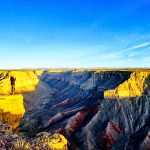
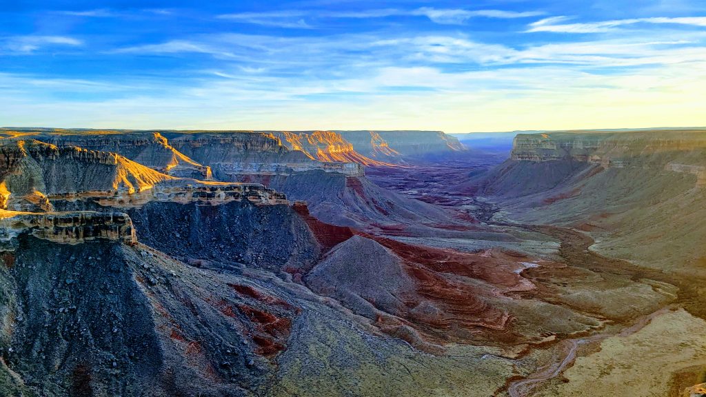
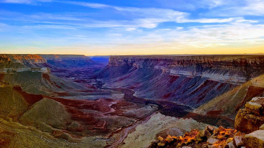
Gunsight Point is a protruding elevated lookout point at the confluence of Snake Gulch on the East and Kanab Creek Canyon on the South. A dramatic scene off the cliffs edge just meters from the end of the road, one can take in a sense of solitude and smallness away from the mainstream masses of the Canyon’s crowded South Rim or seasonal North Rim vantage points. I haven’t yet encountered another vehicle on my visits here. Year round accessibility is a major upside for one looking to get a taste of Arizona’s canyon land country without worrying about the October-May seasonal closures or the distance required to reach the North Rim vistas of Toroweap.
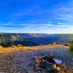
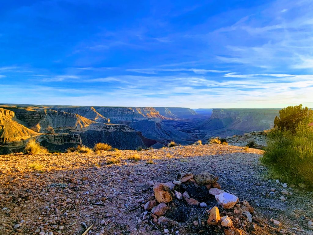
Gunsight Point offers a fantastic place to picnic or campout around a campfire (the ring for which is already built and in a premo location just past the parking area). An overnight visit spent camping here (just remember no hookups) would allow for epic views and photos in both the golden light hours of the late afternoon’s sun as well as early morning’s first sun rays illuminating the canyon below. Not to mention the mind blowing views of the stars! So for a truly intimate experience with Arizona’s North Rim canyon scenery, Gunsight Point is my highest recommendation!
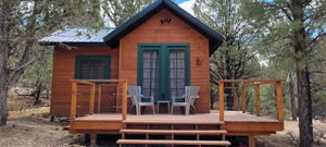
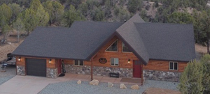
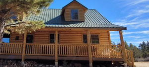
Our Vacation Rentals:
Save Up to 15% When You Book Directly
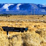
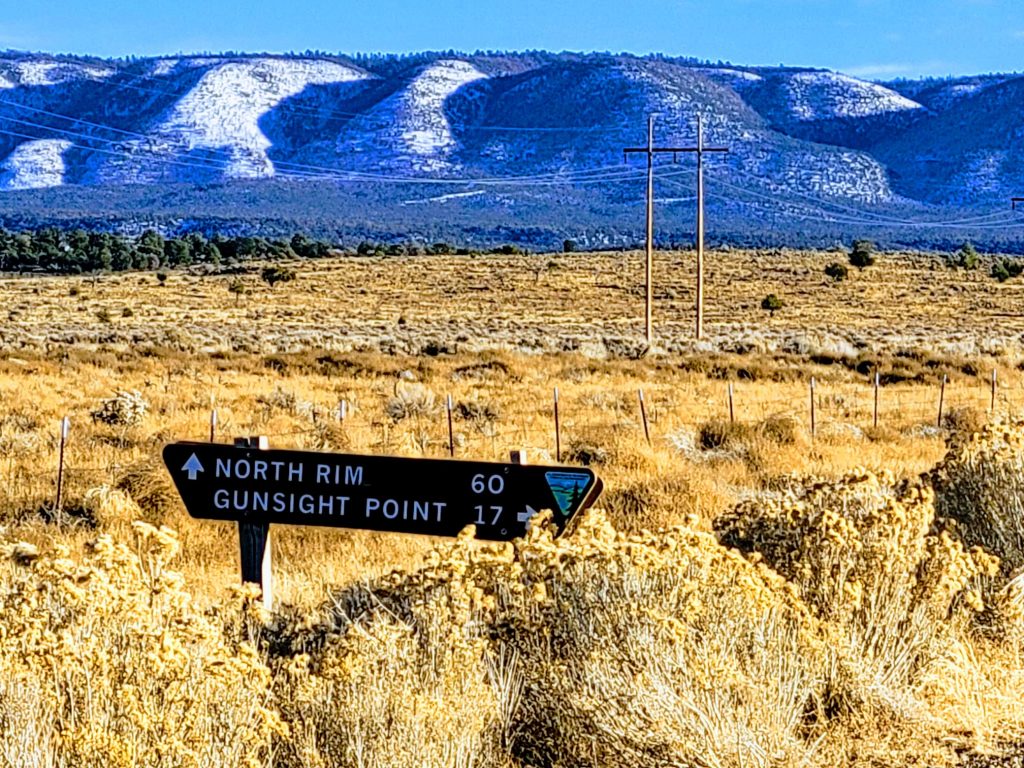
Getting to Gunsight Point:
Traveling South from Kanab drive on highway 89A 8.7 miles through the small town of Fredonia (being sure to slow all the way down to the posted speed limit as I’ve personally witnessed dozens of drivers having been pulled over in the course of a single afternoon) then take a right turning South onto Forest Service Rd 22. Continue South for 12 miles before taking a right onto Gunsight Rd 1048, identified by name on a road sign at the turnoff and simply as 1048 thereafter. Continue on this road for 17 miles until reaching the end (a very steep cliff) with parking near a large tree. 36.653652, -112.618545 The entirety of 1048 is unpaved and caution should be exercised following heavy rains when the road can become quite muddy. Any vehicle with a moderate amount of clearance and a driver with an average amount of common sense should be able to safely get you to this picturesque destination.
Written by: Jacob Thompson