
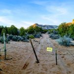
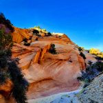
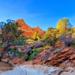
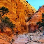
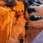
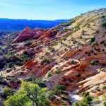
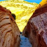
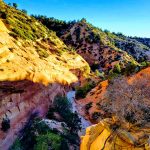
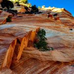
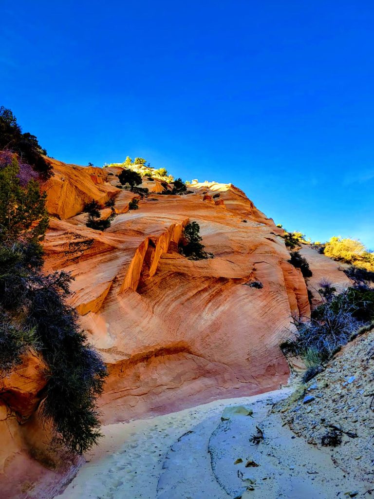
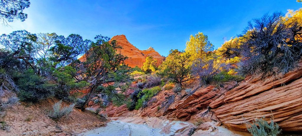
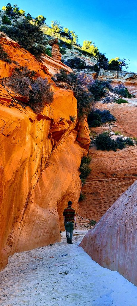
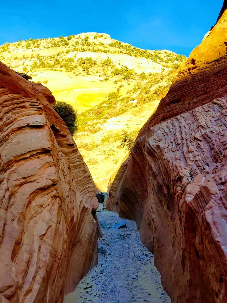
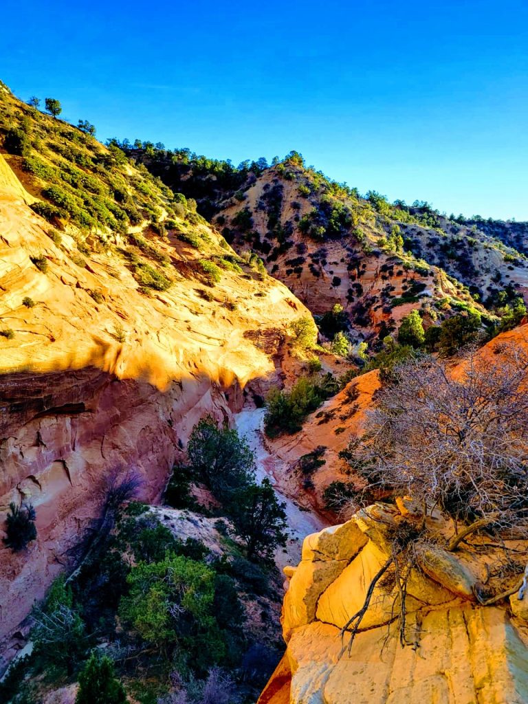
Huntress canyon, less popular and far less traversed than nearby Peek-A-Boo, makes for a notably scenic and fairly quick get away off the Highway-89 thoroughfare. Tucked behind the towering white cliffs of Diana’s Throne a mere 1.2 miles from the main highway, instantly one feels the seclusion and serenity of this place. A short but steep scramble down a gnarly OHV path (one I would not personally recommend regardless of one’s off road rig) and you’ll find yourself in the wash at the bottom of the canyon. A 1.5 mile easy trek leads the adventurer to the effective end of this box canyon. A destination where walls of red stone tower and evidence of water which carved the path taken can be observed. The trail consists of soft white sand which reveals the presence of recent visitors of both human and wildlife pursuations. A cluster of eye catching toadstool formations compliment the wavey sandstone along the trail. These desert waves contrast the markedly sharp breaks where the effects of water and the tenacious root systems of resilient desert flora split slabs of solid rock the size of houses in two. If experienced toward late afternoon, the sun’s soft rays semmingingly turn up the temperature of the high desert colors in a spectacular fashion! Be sure to pack your camera (or definitely charge that super high quality one most of us carry in our pockets everywhere nowadays). The lower the sun sinks the more brilliantly the colors all around you seem to explode! As icing on this outing’s cake, high points of the trail afford spectacular views of Zion National Park’s iconic geography on the western horizon. If embarking during the late afternoon be sure to bring a trusty headlamp or return before dark if at all possible. For me at least, this just makes for a more enjoyable and less stressful trip.
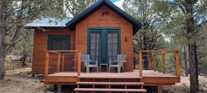
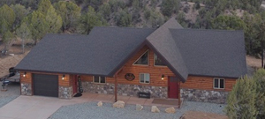
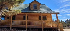
Our Vacation Rentals:
Save Up to 15% When You Book Directly
Directions:
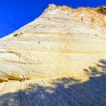
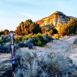
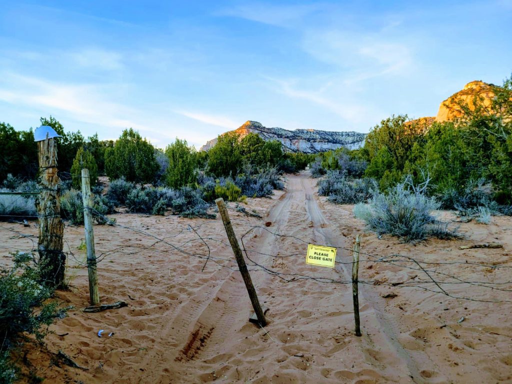
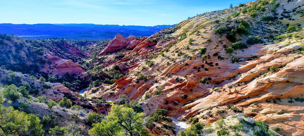
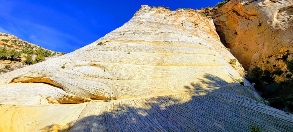
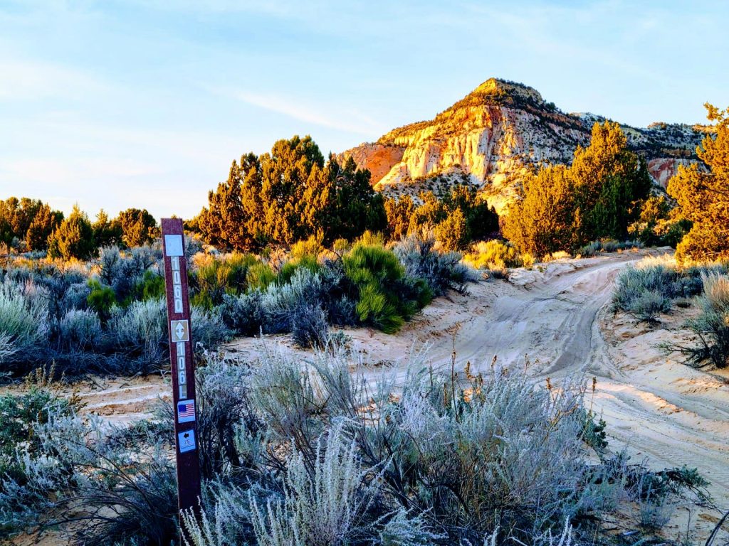
To get to Huntress Canyon from Kanab drive North on Highway-89, turn right just past mile marker 76 and the sign designating the 6100ft Summit onto road 106L. Stay on 106L through the gate (be sure to close behind you as the sign instructs) and drive 1.2 miles, continuing to stay left being sure to observe every road marker at each junction to get to 106T where you park at the turnout. The coordinates for the parking spot are 37.1904796, -112.6455678. Hike down the steep dirt hill to get to the bottom of the canyon to begin your hike. A detour up road 106Q offers spectacular sweeping views of Huntress from above as well as an up close experience with what I termed the “Yellow Wave”. An incredibly unique and picturesque rock formation making up the back of the canyon just southwest of Huntress. Definitely worth the time if you’ve got a 4X4 and the clearance necessary for it!